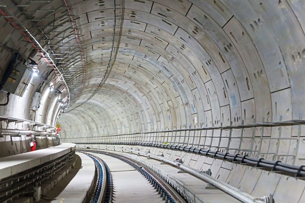
MRT Putrajaya Line underground tracks near the Hospital Kuala Lumpur Interchange.
Have you ever wondered how engineers design tunnels for rail projects? It takes a lot more than just digging a hole in the ground. We need the proper tools and planning to ensure our tunneling projects are efficient and safe, especially when the project requires a high level of terrain awareness.
Civil 3D is a part of a suite of software programs offered by Autodesk specifically designed for civil engineering and infrastructure design. In our Sydney Metro West tunneling project, we have utilized Civil 3D to solve pressing issues in large-scale infrastructure modelling.
”Horizontal projects such as tunnels or roads are much more efficient when modeled using Civil 3D, because we have to take into account the vast land and topographical data.
Nik Mohd Faiz Bin Nik Kamrulzaman
Senior BIM Executive
Building Better With Civil 3D
In this article we will focus on how Autodesk Civil 3D helps us plan and design better tunnels for a rail project from conceptualization to construction.
Actionable Data: One of the most significant benefits of using Civil 3D is its ability to create detailed visualizations of different topography scenarios, such as slopes or elevation. With powerful tools built into the software, we can design 3D models of roadways, tunnels, and bridges, making it possible to visualize and analyze the design in real-time.

Vehicle Tracking: An interesting feature built-in Civil 3D is vehicle tracking, where you can simulate vehicle movements in your project including swept path analysis and parking areas. We use this feature to ensure the design will not pose any problems to vehicles that will eventually be using the infrastructures.

Corridor Tool: In Civil 3D we can create a configurable corridor 3D models using profiles, which is very useful in designing horizontal infrastructures such as roads or rails. We can also modify the parameters to adopt to new data and it will automatically reflect in the profile and corridor design.
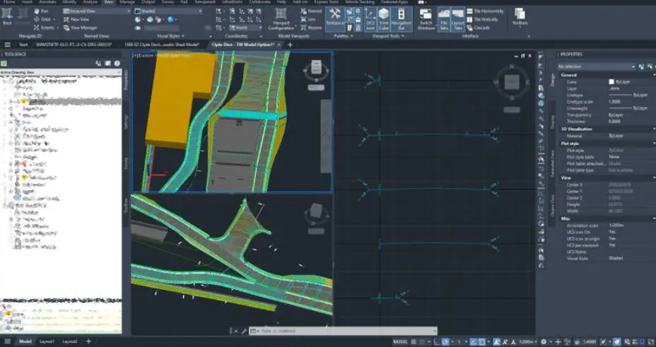
Overall, in regards to our Sydney Metro West – Western Tunnelling Package, having a robust software such as Civil 3D makes it easier for us to communicate design with Australian authorities and planning bodies. This expedites certain processes as we can check for clashes and better adhere to the regulation set out by the relevant authorities.
Tunneling Through the Future
”We have an advantage when we talk to potential clients for future projects because we can visualize these large-scale projects better using Civil 3D
Azfarhan Bin Idris
BIM Modeller
Our team agrees there are more to explore in terms of use-cases in using Civil 3D. However, knowing the right software is just one part of the overall process of any infrastructure project, thus we are also heavily investing in training and making sure our stakeholders are within the right mindset when working with specialized BIM software.