Successfully planning and executing large-scale infrastructure projects demands careful attention to detail and proactive planning. To better handle these complex challenges, we’ve integrated the use of Geographic Information Systems (GIS) with digital engineering. This combination enhances our capabilities, allowing us to more efficiently map, analyze, and manage infrastructure development with greater precision and effectiveness.
Harnessing the Power of NearMap for Infrastructure Development
Regularly updated, high-resolution imagery from Nearmap brings unparalleled clarity to our planning processes. This enhances our decision-making, offering precise land use and infrastructure mapping while significantly reducing time and costs by minimizing the need for on-site visits.
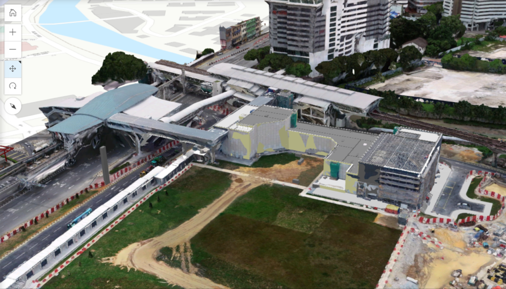
With Nearmap’s visualizations, we accurately represent environments at the outset of our projects. This facilitates informed and precise planning, as highlighted by our works in the Suburban Rail Loop, a 90km orbital line that will connect all major suburban lines in Victoria, Australia.

Nearmap really saves us time and cost as aerial images provided follow strict regulations and require minimal post processing.
Wan Hamizi Wan Taha
GIS Manager
From Nearmap to Digital Engineering: A Seamless Integration
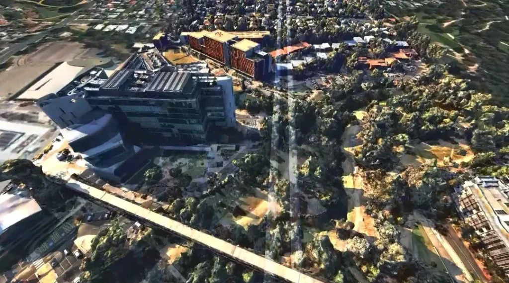
Nearmap’s versatility in providing a range of file types is a key asset. Whether it’s flat 2D images or detailed 3D models, these resources integrate seamlessly with our Building Information Modeling (BIM) software.
This integration crucially informs our modelers about the specific environmental context of their projects, enhancing accuracy and efficiency in our planning process. Using sophisticated BIM software, we are able to overlay infrastructures such as buildings, rails, and tunnels into realistic representation of the area of development.
Integrating Nearmap data with modeling software like InfraWorks has been transformative; it not only supports our tender submissions but also serves as an invaluable tool for stakeholder engagement.
Azfarhan Bin Idris @ Ilham
BIM Modeller